Spotter Information
SKYWARN® Spotter Training

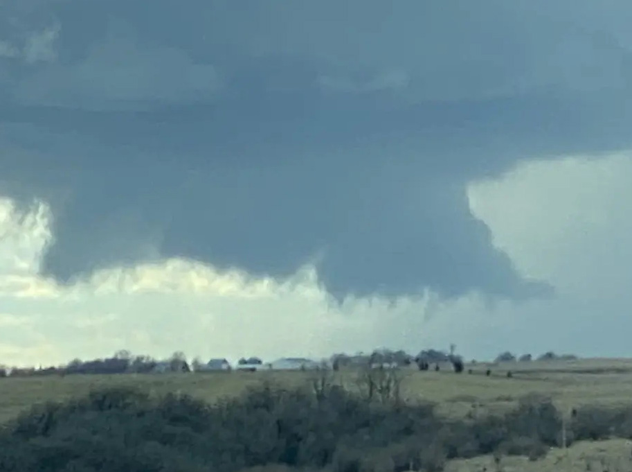
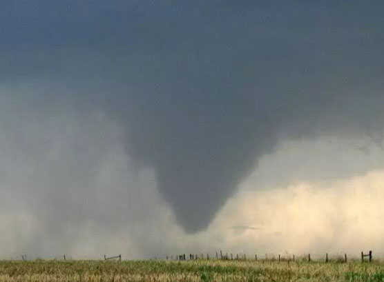
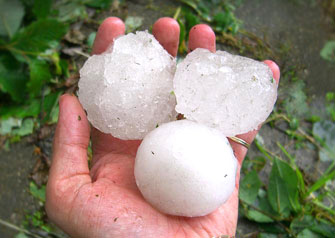
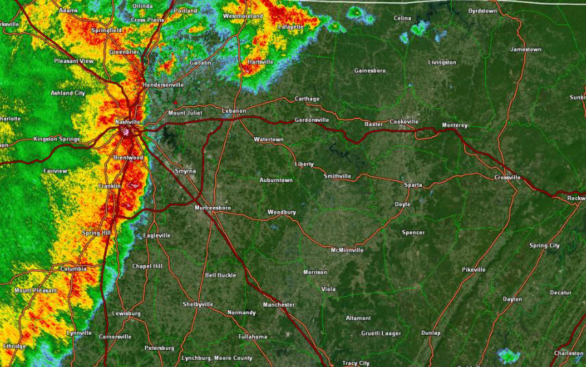
SKYWARN® spotter training prepares volunteers to serve as critical observers during severe weather events, equipping them with the knowledge to recognize and report hazardous conditions accurately. Conducted by the National Weather Service (NWS) Morristown office (MRX), these free sessions teach participants how to identify key storm features - such as wall clouds, rotating updrafts, and hail sizes - while emphasizing safe spotting practices. Topics include understanding thunderstorm dynamics, spotting tornado precursors, and using tools like NOAA Weather Radio for real-time updates. Classes are offered at least annually, typically in late winter or early spring (February-March), with additional sessions scheduled as needed based on weather threats or volunteer demand. Training is available both in-person at locations across Roane, Morgan, and Scott Counties and online via webinars or the COMET/MetEd platform, ensuring accessibility for all District 4 volunteers. No prior experience is required - just a willingness to learn and contribute to community safety.
2025 Training Sessions for District 4 (Roane and Morgan Counties)
- Roane County: March 13, 2025, 7:00 PM EDT at Rockwood Community Center (710 N Chamberlain Ave, Rockwood, TN 37854). Contact: Cliff Segar (kd4gt.tn@gmail.com). Registration: NWS MRX Schedule.
- Morgan County: Thursday, April 24, 2025, 6:00 PM to 7:30 PM EDT at Emergency Ops Center (park lower lot), 274 Ralph Hamby Ln, Wartburg, TN 37887. Contact: Ethan Webb (emermgmt@highland.net). Registration: NWS MRX Schedule.
- Online Training: NWS Morristown (MRX) offers a NEW Virtual SKYWARN® spotter training at this site. It consists of four interactive sections to complete, followed by a final exam that must be taken to receive credit. After finishing the exam, please be patient and understand that up to two weeks may pass between completing the exam and receiving your spotter ID card and certificate. For questions regarding spotter training classes, email Jeremy Buckles or Anthony Cavallucci.
- Additional Training: Enhance your skills with the COMET/MetEd SKYWARN® training at COMET/MetEd platform, offering self-paced modules for spotters.
Check the NWS Morristown SKYWARN® Training Schedule for updates or additional sessions.
Get Involved
SKYWARN® Severe Weather Nets
[Check back soon for information about ham radio nets and repeaters used during severe weather events.]
SKYWARN® Training Nets
[Check back soon for details about regular training nets for spotters.]
Join the East Tennessee SKYWARN® Discord Server
DISCORD:SKYWARN #d4-General
Naming Convention: "Callsign-FirstName-D4"
Follow Us on Social Media
Facebook:TN SKYWARN District 4 - Roane, Morgan and Scott Counties
Twitter/X:@MRX_SKYWARN_D4
Spotter Reporting Techniques
Effective SKYWARN® reporting requires spotters to observe and relay critical weather details quickly and accurately to the National Weather Service (NWS) Morristown (MRX) office. Reports should include concise descriptions of observed phenomena, precise time and location (e.g., GPS coordinates or landmarks), and follow NWS criteria for severe weather events. Below are key reporting guidelines and advanced techniques to enhance your observations, along with multiple channels to submit your reports - empowering you to protect District 4 communities in Roane, Morgan, and Scott Counties.
Reporting Criteria


- Severe Thunderstorms: Report wind gusts of 58 mph (50 knots) or higher (e.g., tree branches breaking, power lines swaying), hail 1 inch (quarter-sized) or larger, or persistent rotation in clouds suggesting a tornado risk. Note storm direction and speed if estimable.
- Tornadoes: Report any funnel cloud extending toward the ground, a visible rotating wall cloud, or a confirmed tornado touchdown. Include debris sightings (e.g., dust swirl, flying objects) and direction of movement. Example: "Funnel cloud 2 miles north of Wartburg, moving NE, 6:45 PM EDT."
- Wind Damage: Report downed trees, structural damage (e.g., roofs off, windows broken), or estimated gusts over 58 mph. Specify extent (e.g., "multiple trees down across Hwy 27 near Harriman") and any injuries if known.
- Hail: Report hail 1 inch or larger, using common objects for size (e.g., quarter = 1", golf ball = 1.75"). Note duration and accumulation. Example: "Golf ball-sized hail, 5 minutes duration, covering ground near Oliver Springs."
- Flooding: Report water over roads, bridges, or into homes, especially if life-threatening (e.g., swift water rescues needed). Include depth (e.g., "6 inches over Hwy 62 near Morgan County line") and rising trends if observed.
- Other Hazards: Report heavy rain (1 inch/hour or 2 inches in 3 hours), lightning damage (e.g., fires, injuries), or snowfall rates exceeding 1 inch/hour in winter events - vital for MRX forecasts in District 4’s varied terrain.
Advanced Reporting Techniques

- Use Technology: Leverage smartphone apps (e.g., RadarScope) or GPS for precise location data (latitude/longitude) to supplement visual landmarks. Time-stamp photos or videos of events for later submission if immediate reporting isn’t safe.
- Estimate Wind Speed: If no anemometer, use the Beaufort Scale (e.g., small branches moving = 13-18 mph, whole trees in motion = 39-54 mph) or observe effects (e.g., shingles lifting = 50+ mph).
- Track Storm Motion: Note compass direction and approximate speed (e.g., "moving NE at 20 mph") by observing cloud bases or precipitation shifts over 5-10 minutes - helps NWS refine warnings.
- Coordinate with Others: During nets, cross-check observations with nearby spotters via ham radio to confirm phenomena (e.g., "KX4ABC reports same funnel cloud 5 miles west").
How to Report
Submit reports promptly using one of these channels, ensuring you’re in a safe location first:
- Ham Radio: Relay via amateur radio to NWS Morristown during active SKYWARN® nets (details in "Severe Weather Nets" section above) or through local repeaters monitored by MRX.
- Phone: Call the NWS Morristown office at 1-800-772-2031 (toll-free) with urgent reports like tornado sightings.
- Social Media: Post to NWS MRX Facebook, tag @NWSMorristown on X, or use District 4’s TN SKYWARN District 4 - Roane, Morgan, and Scott Counties Facebook Group or @MRX_SKYWARN_D4 on X. Include #SKYWARN® and location tags.
- Online Form: Submit via the NWS MRX Spotter Report Form for non-urgent observations.
Example: "Quarter-sized hail, 3 miles east of Kingston, 2:15 PM EDT" reported via ham radio net or tweeted to @NWSMorristown with #SKYWARN®.
SKYWARN® Spotter Safety Tips
- Prioritize Personal Safety: Never chase storms or place yourself in harm’s way to get a better view. Your life is more valuable than any report - observe from a secure position.
- Know Your Escape Routes: Stay aware of multiple exit paths in case conditions worsen rapidly. Avoid low-lying or flood-prone areas, especially near rivers like the Clinch or Emory in District 4.
- Monitor Reliable Sources: Use a NOAA Weather Radio, mobile alerts, or trusted apps for real-time updates to stay ahead of approaching threats - don’t rely solely on visual cues.
- Report Safely: Submit observations from a stationary, sheltered location - never while driving through heavy rain, hail, or high winds. Pull over if travel becomes hazardous.
- Avoid Exposure to Elements: Stay out of open fields, under trees, or near power lines during thunderstorms to reduce lightning and wind damage risks. Seek sturdy shelter if possible.
- Prepare in Advance: Keep a safety kit (flashlight, water, first aid, charged phone) in your vehicle or spotting location, especially during severe weather outbreaks in East Tennessee.
- Communicate Wisely: If using amateur radio or phone to report, ensure you’re in a safe spot first - don’t compromise your position to make contact. Delay non-urgent reports until conditions stabilize.
- Stay Informed of Local Hazards: Be mindful of regional risks like flash flooding in Morgan County’s rugged terrain or downed trees blocking roads in Roane County - adjust your spotting strategy accordingly.