East Tennessee SKYWARN® District 4

The SKYWARN® program, launched by the National Weather Service (NWS) after the devastating 1965 Palm Sunday tornado outbreak that claimed 271 lives, stands as the nation's first line of defense against severe weather, harnessing the power of 350,000 to 400,000 trained volunteers nationwide - including East Tennessee's SKYWARN® District 4. Each year, the U.S. faces over 10,000 severe thunderstorms, 5,000 floods, and 1,000 tornadoes, causing hundreds of injuries, deaths, and billions in damages from storms, lightning, and floods. SKYWARN® spotters, drawn from diverse backgrounds like emergency responders, ham radio operators, and dedicated citizens united by a passion for weather and community safety, provide real-time, ground-truth reports of tornadoes, large hail, wind damage, and flooding. In District 4 our mission is to lighten the NWS Morristown (MRX) load by delivering accurate and timely reports of weather conditions locally to NWS MRX meteorologists and local emergency responders via a variety of methods, including ham radio, online report forms and social media. These efforts, paired with Doppler radar, satellites, and other technologies, enable meteorologists to issue faster, more accurate warnings - giving families and neighbors precious minutes to protect lives and property.

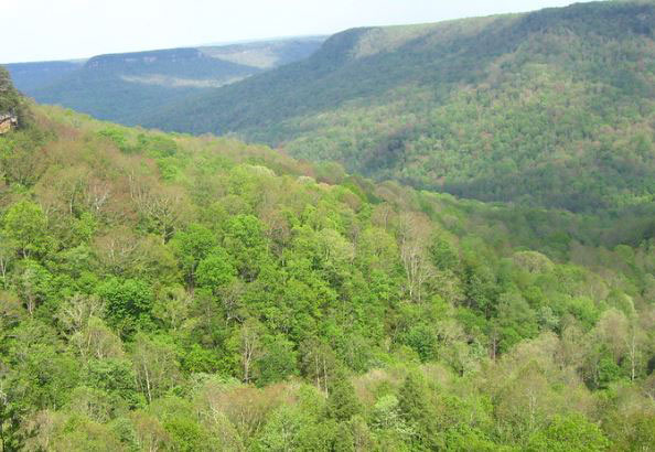
East Tennessee SKYWARN® District 4 serves a vital region encompassing Roane, Morgan, and Scott Counties in Tennessee, an area under the NWS Morristown (MRX) forecast office. This district spans diverse topography, from the rolling hills and river valleys of Roane County along the Tennessee River, to the rugged, forested escarpments of the Cumberland Plateau in Morgan and Scott Counties, where elevations climb from around 800 feet in the valleys to over 3,000 feet atop plateau ridges. Forecasting weather in East Tennessee is notoriously challenging due to this dramatic variation in elevation and the presence of microclimates - small-scale weather patterns influenced by valleys, ridges, and proximity to bodies of water like Watts Bar Lake. These factors can lead to sudden shifts in temperature, precipitation, and storm behavior within just a few miles. As the first district to encounter weather systems transitioning from the NWS Nashville forecast area into the NWS Morristown area, District 4 plays a critical role in tracking these systems as they move eastward into the Tennessee Valley. SKYWARN® spotter reports from this region are essential for providing real-time conditions on the ground data, helping meteorologists refine warnings as storms navigate this complex terrain.
District 4 Coordinators
- SKYWARN® District 4 Coordinator: Jean Mayo (k0ljm@etnskywarnD4.com)
- SKYWARN® Assistant District 4 Coordinator: Bart Mayo (k0gyo.bart@gmail.com)
- Roane County SKYWARN® Coordinator: Cliff Segar (kd4gt.tn@gmail.com)
- Morgan County SKYWARN® Coordinator: TBD
- Scott County SKYWARN® Coordinator: TBD